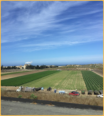
On the road again! Around 10:00 a.m. on May 13th we steered towards Tuba City and Navajo Indian country. We got advise from other campers who told us to be sure we took I-40 east then north on AZ64 towards the Grand Canyon. That way we could get another view of the great canyon from our coach as we drove along the south/east rim.
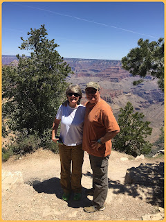
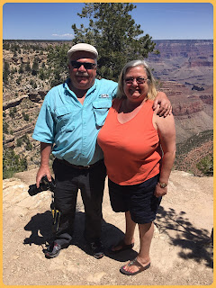
So, we took the good advice and re-entered the Grand Canyon National Park (again, it was free again using Rick's senior Golden Age Pass). This time we were able to see the canyon from a different perspective, which was really cool...stuff we missed taking the train days earlier.
Our drive took us through the Kaibab National Forest and I saw some more roadsigns a Florida girl isn't prone to see very often.
The drive was gorgeous! We found several opportunities to pull over in scenic areas that were plenty long and wide enough to fit a motorhome our size pulling a car. The highest elevation we encountered on the rim was 7,448 feet and it afforded some amazing pictures along the way.


 We stopped at the Desert View Watchtower, also known as the Indian Watchtower at Desert View. Stretching 70 feet high and constructed in 1932, this native stone structure also had an observation deck that allowed visitors to view the eastern portion of the canyon. The tower is on the National Register of Historic Places as of January, 1995. Mary Colter, a former employee of the Fred Harvey Company, designed the Watchtower (as well as various other buildings within the National Park) and many believe it to be her Grand Canyon masterpiece. Now before I let you see the pictures, here is an interesting tidbit: I mentioned the Fred Harvey Company just above. Fred Harvey was an entrepreneur born in London who developed the Harvey House lunch rooms, restaurants, souvenir shops and hotels that helped shape America's past. Mr. Harvey was instrumental in promoting tourism in the Wild West through his high standards and chain of restaurants catering to railway passengers. He also set up "Indian Detours" meant to provide authentic Native American experience by having actors recreate a certain lifrstyle in the desert. Wayhouses, now used by rangers and park employees, are still present in the Grand Canyon National Park and were built by Harvey for tourists. Harvey's influence, through his innovativation and marketing skills, brought people out west and to the canyon. Now, for those awesome pictures I promised you...


After our canyon experience, we turned north on Navajo Trail/US89 through Monument Valley. Wow, what scenery!!
The landscape turned SO barren and civilization seemed to disappear. An itty-bitty town called Cameron, located in Navajo Country, came into view. We had to stop to fuel up the rigs. We felt so remote and "alone" in this town.
Then we reached Tuba City, the Navajo Nation's largest city. At this point we had travelled 3,301 miles since we left home. Tuba City was heralded by an unusually nonchalant type sign.
Having crossed into Navajo Land, we were then following Daylight Savings Time (unlike the state of Arizona) so we had to move our clocks back one hour. We found our campground located behind a Quality Inn hotel.
Ralph and Janet pulled their rig next to ours in the parking lot and we all went into the hotel lobby to check in.
Greetings from Navajo Country. Very nice.
"Ya' at' eeh" is the Navajo greeting usually followed by a handshake. Literally it means "it is good". It also could mean "good morning". Tribal tattoos (tats) are also a way of displaying your ancestry and "talk" volumes. All walks of life greet with a family last name or tribe to indicate ancestry and lineage in an immediate way of communicating.
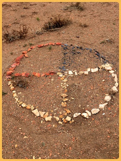
I saw some unusual creatures around our campground - one on the back of a motorcycle and one ex-camper's way of expressing their humor up in a tree. Cute.
Navajo wedding basket and sculpture adorn the lobby of the hotel that was the front of our campground.
We drove around the Navajo town (quite small) then ate at the hotel on-site restaurant for dinner, trying their Indian Taco. It was fried bread with lettuce, tomato, cheese and ground meat...like a large, soft tortilla taco.


Approximately 15 miles southeast of Tuba City was the gorgeous Coal Mine Canyon. Oh my...worth seeing for sure. We did not need a permit to travel there. Not signposted in any way, this gem was located off AZ Highway 264 and was a dirt road turnoff on the left before mile marker 397. The windmill on site is iconic but we didn't see it from the road. Our SUV came in handy many times on this trip and this was no exception. The potholed, dirt road was a 4x4 adventure and seemingly went no where. The horizon tricked the eye into (what seemed) endless, flat, dirty plains. However, suddenly the earth opened into a spectacular display of colors, textures and form carved by time in sandstone rock. This wonder lies on the outskirts of the Painted Desert inside Navajo country limits of northern Arizona.


We witnessed rock climbing goats in the canyon who eventually herded themselves into a group and climbed out of the canyon walls and onto our trail in front of the car. We watched in amusement as they ate what little grass seemed to grow along the road. It was so dry and the river beds were almost void of any water.
Oddly, the Navajo sat right next to a Hopi Indian Reservation and the only discerning invisible "line" between one property and the other was a marquee below a McDonalds sign that announced your arrival. The two nations shared two different time zones so crossing from one into the other meant changing watches if the stay was going to be a bit long.
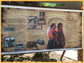
Tuba City had a Trading Post that was part museum and part several store/souvenir shop. It was interesting to walk through and was only walking distance, across the hotel parking lot, from our camp site. Unfortunately we missed the operating hours of the museum as it had closed but we did learn some things about the Navajos and their way of life.
Traditional Navajo religion practiced living in hogans, or cone-shaped homes made of wooden poles, tree bark and mud. Even if the person lived in a newer style home, they would have a hogan on property additionally for ceremonies and to stay "in balance". These hogans were sacred for the Dine' (Navajo) people. The doorway opened to the east so the morning sun greeted them and they could receive good blessings.

 The museum supposedly had an exhibit about the Code Talkers, which I would have loved to see. Navajo Code Talkers were invaluable during World War II to our American Marines. Recruited Navajo were bilingual and spoke their obscure native Navajo, a language very few understood and it was a means of secret communication during wartime. It was used as a basis of transmitted coded messages. There were approximately 400-500 Native Americans in the United States Marine Corps who sole job was the transmission of secret tactical messages. It worked. We owe them a debt of gratitude.
This wall on the side of a building depicted the parts of the Navajo Night Chant and prayer known as "The Beauty Way". It is a blessing and the Navajo term for their spiritual path and their practice of the holy life. Quite lovely and peaceful.

We ended our stay in Tuba City and headed northeast to Utah, our next stop on the map. Our planned drive would take us through Monument Valley as we followed US-160 E route. This country was beautiful! It was wide and open with very little motor vehicle traffic around. For my old movie buffs (like me), it reminded me of that scene in Alfred Hitchcock's North By Northwest where Cary Grant got off the bus and stood in the middle of seemingly nowhere. The camera panned 360 degrees around him and it looked desolate and endless. Monument Valley is approximately 96 miles from Tuba City and it was worth seeing. This was one of the most majestic - and is one of the most photographed - points in the United States. Sandstone masterpieces, colors changing from greens to corals and yellows and deep maroons...it inspired awe. This land extended over 91,696 acres from Arizona into Utah and rose 5,564 feet above sea level. This tribal park of the Navajo Nation was a highlight of our trip.


Onwards we moved towards Utah, our next destination. Join me in our next adventure: Utah - (Part 1) Moab and Arches